A post on Tangible Books instagram showed that they had got in a copy of Picturing America: The Golden Age of Pictorial Maps, and so I ran over and bought it. I’ve been looking through it. You can click here for much of its contents in the form of an Hornsby-curated exhibition now archived on the Osher Map Library’s site, along with many amazing scans & info from Hornsby’s book.
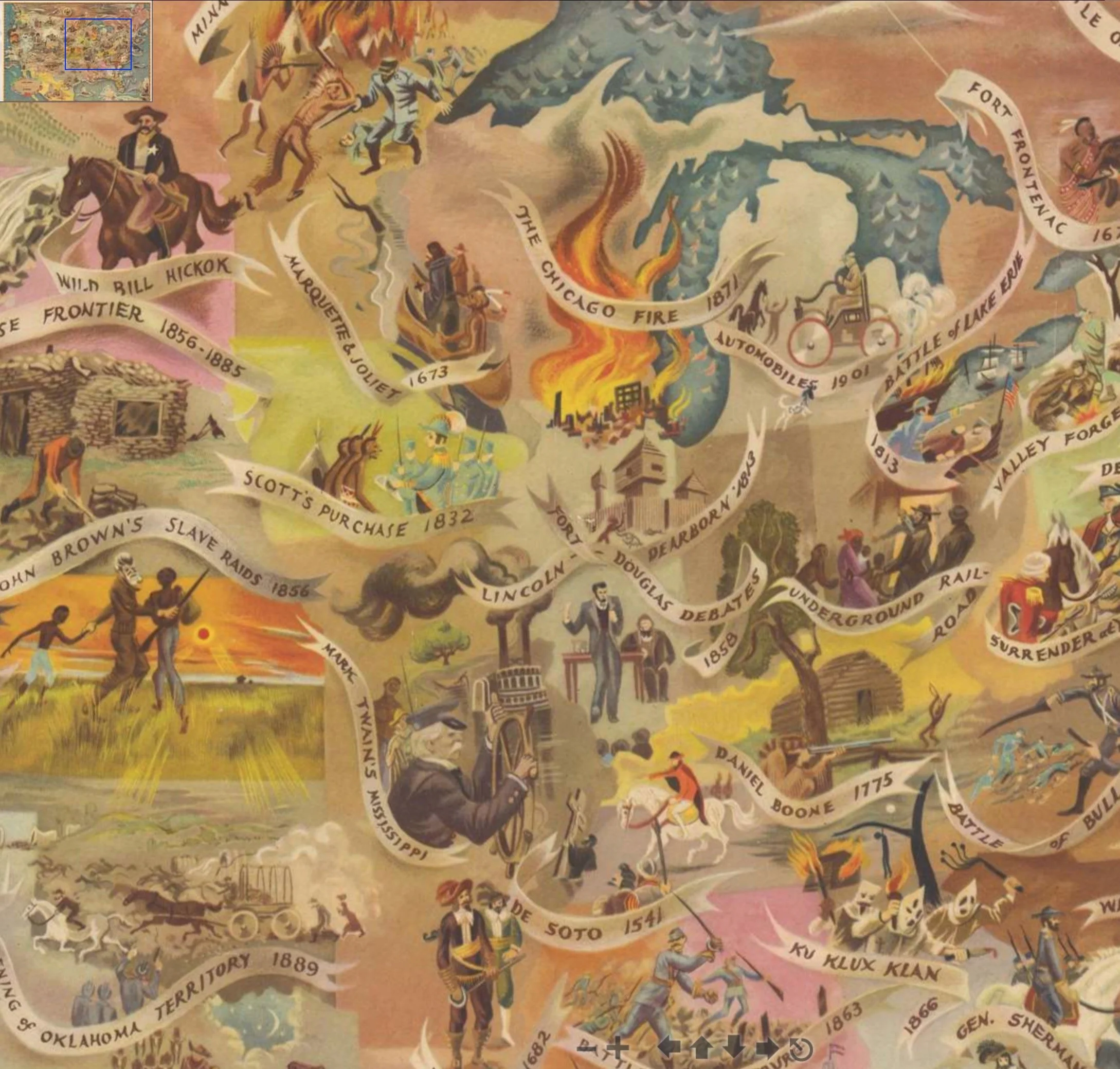
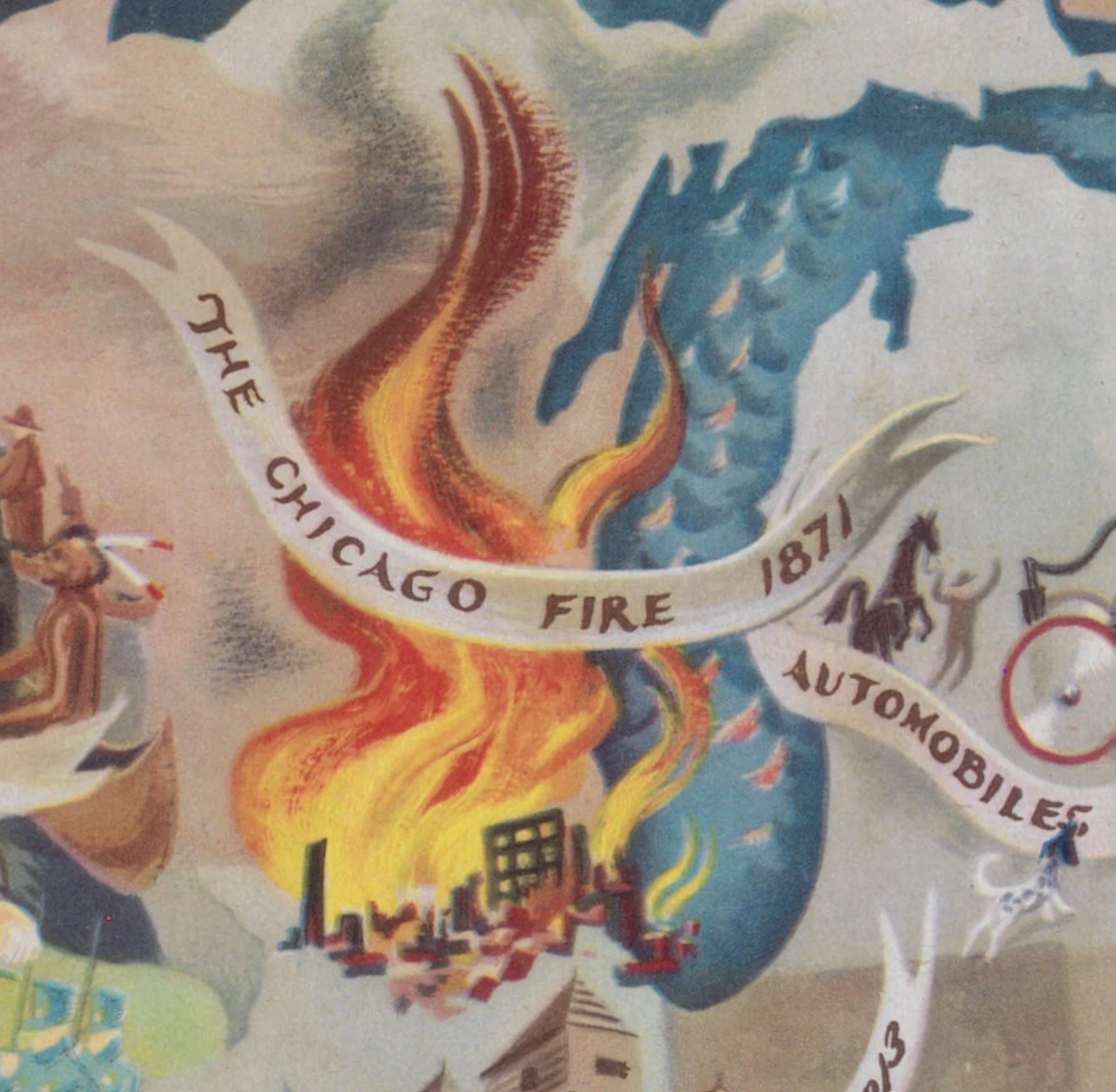
I keep coming back to this, in the book, a frustratingly small reproduction of a map by Aaron Bohrod, Aaron Bohrod’s America Its History, from 1946. I posted about the book on my instagram feed here. Looking around the internet to find a better version, I came across these links. You can click around and zoom in on the map and see the amazing details, even though the lighting and color isn’t so hot. I’m still looking around for better scans/pics.
Aaron Bohrod is a new character to me. Wikip. says “Bohrod was born in Chicago in 1907, the son of an emigree Bessarabian-Jewish grocer.[6] Bohrod studied at the School of the Art Institute of Chicago and the Art Students League of New York between 1926 and 1930.[2]” (Pictorial History was published by UChicago Press, another Chicago connection. Now that I’m in Chicago is it strange how the universe keeps showing me more and more Chicago, everything connected and nearby? The fire below in the detail is striking.)
I’ll look more into this and try to find a better scan/pic and update this post.